Pyrenees adventure

This site contains affiliate links for which LandyZone may be compensated if you make a purchase.

LetsHopeItFits

Active Member
Posts
379
Location
North Wales
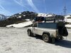
So my friend and I plan on doing a trip this summer to the Pyrenees, and we'de love some advice regarding the route. We're planning for 3 or 4 weeks, and we'll either be going in my 1996 3.9 V8 Discovery, or a 200tdi manual Range Rover, if Ive made the switch by then (hopefully, because it hlaves the fuel expense)
So its going to take us at least 3 days to reach the mountains, as we're coming from North Wales. Which ferry we take is yet to be decided, and it doesnt really matter, we might do a loop, using the Santander ferry one way and a french ferry the other.
As for advice with the car and camping situation, we plan on tenting, since it will be June or July. Ill be sure to pack all the stuff the french have decided we must have (hi-vis, safety triangles, breathalizers, onions etc) and that the car is fine and that we have adequate spares, tools and manuals to fix any issues that may arise. Worst case our roadtrip becomes a backpacking holiday. UK insurance includes third party cover in the EU, Andora etc. We wont be cannonballing our way through France, since I'm the only driver, and Ive never driven on the wrong side of the road before, but I've also read that offroad driving isnt allowed in France, and we arent particularly interested in cheese, so we won't be stopping all the time either (except for a cheeky baguette perhaps)
Really, we'de be greatful of any advice as to where to go, where to find maps of the tracks and so on, because google maps wont take us there. We want an adventure, not a holiday. Remoteness, wilderness, challanges etc. We've left ample time to plan the trip, but I'm struggling to find the destination.
We are uni students, so the budget doesnt stretch to guided tours, even if thats what we fancied. If we end up going in the disco, its litterally the ferry, the fuel, some food and drinks, and thats it. None left for hotels etc. Hopefully I'll have got the RRC, which halves the greatest expense, fuel. Either way, we REALLY do not want a fine of hundereds or thousands of euros.
(P.S. incase you're concerned, Ive done enough greenlaning locally to know what I'm doing, and we've both done plenty of camping, so it really is just the path through the mountains we seek to pick your brains for!)
(P.P.S There will be a thread for the range rover, as it progresses for use on more of these trips, Iceland in the winter, hopefully Africa next summer, as well as being a daily driven lane muncher!)
Thanks!
 
Last edited:
Hi mate we normally travel Calais to Rouen about 12E of tolls then pick up the n154 Chartres, Evreux then pick up the route national south you can travel nearly to Clermont Ferrand with out tolls it is a meandering route but better than the tolls, from Clermont to the coast there is a free motorway apart from the milieu bridge spectacular scenery, big steep climbs one of the highest roads in Europe we take about 3 to 4 days 300km a day, look up municipal camp site basic but cheap TD5 struggled with caravan on some climbs enjoy
 
Hi, thanks for your response
We arent too concerned about the route to get there, google maps can do that (incliding avoiding tolls) but we do need advice to find the interesting bits in the Pyrenees (you wouldnt get a caravan there, hopefully!)
 
Hi
I have lost count of how many trips I've done in & around the Pyrenees.
When I first started going,around 15 years ago,I bought road books from,Votre voyage avec les Road books de Vibraction - road books Vibraction
The road books are all in French so that maybee an issue if you dont speak/read French.I have also found routes through Wikilock.
On the French side of the Pyrenees there are almost no off road routes that can legally be driven,on the Spanish side though,fill your boots,there are very few restrictions.
In the area Val d' Aran are some of the famous smugglers tracks from Spain to Andorra,a must do IMO,Beware though,don't use your mobile phone in Andorra unless you really have to.The charges are astronomical.....Guess how I know?
I you can venture a bit further South,then the Bardenas Reales is worth a look.(Google it)Then further West is the Picos d' Europa,just South of Santander.
Good luck & have fun.
Marc.
 
I followed some of the routes these guys did. Wikilocs v. useful, don't miss the Picos d' Europa.
 
Really, we'de be greatful of any advice as to where to go, where to find maps of the tracks and so on, because google maps wont take us there. We want an adventure, not a holiday. Remoteness, wilderness, challanges etc. We've left ample time to plan the trip, but I'm struggling to find the destination.

Have a look at wikiloc (LINK). I have used it for italy, northern spain and morroco. you can search trials of all sorts of transport form offroading to kayaking. you can then download the trial and follow it like a satnav. It will then record your trail and you can upload this as well for future people to follow. They are all trails recorded in this manner so they have all bene done by someone. you just need to check the dates to make sure it is recent enough to follow, and that it is actually a right of way. I have found a combination of this and google maps satellite view is a fairly good way to plan off road trials in countries you are not familiar with.
 
We did the Pyrenees last year, first big trip was solo vehicle missus and me, the vehicle was a barn find i had done up see thread https://www.landyzone.co.uk/land-rover/potential-110-project.365519/

re the Pyrenees
Travel
we elected to go Plymouth to Santander, ferry crossing 20 hours best ship on Brittany Ferries with a cabin £900 rough no
Other crossings are longer like Portsmouth to Bilbao but that is 33 hours and more expensive
we costed in dover calais plus fuel and tolls and that route is cheaper but not by very much and someone has to drive the 800 ish miles (Calais to Santander) to Spain each way with the wear and tear on a vehicle. also you are adding 1600 miles round trip onto an old vehicle that is no motorway cruiser..lol.
with the spain ferry you arrive fresh and in the heart of the action

Tonnes of tracks in spain, we used a wikiloc on an ipad tablet and a iphone with google maps. We purchased Spanish pay as you go Vodafone Sim cards to ensure no unexpected phone bills and we also had issues with data access on the UK sims. Spanish sims were faster more reliable and cheap we bought 2 one with 10 gb and one with 15Gb spent £25 never used half the data they have 4g to good signal 95 % of the time.

Once we got used to using the two together we were absolutely fine. I have notes of tracks or routes we used. we went from west coast to east coast have names of some campsites we used but we camped wild a lot, just be careful and smart where you do. You are prohibited to wild camp but can bivouac so arrive after 8pm leave pre 8am. we used to find a spot 6 or 7 pm put the awning up make food sit and eat and chill if not disturbed, roof tent up about 9pm, up at dawn 6.30 ish pack up and go., then have breakfast about 8 or 9 am when the sun is up on a track somewhere. We had no hassle hardly saw a soul off road odd farmer, but no hassle at all, never saw an english no plate for 9 days. campsite were super friendly and not expensive. we broke down and had 4 offers of help. had it in bits on the side of the road. Spanish people were lovely happy to see you especially when you are in rural villages and markets etc.

We also did some of the Raptors garage route, did Bandanas Reales but was disappointed long drive south to see it, lots of them you are not allowed near and the photos and video you see on Youtube are the only one you can get close to but is surrounded by coaches of tourist, spent the next morning getting all the dust out of the landy.. We wont be going there next month.

we are going back 3rd May for 2 weeks again with some different routes planned, this time into Andorra which we had to detour last year due to too much snow on the tracks.

If you can get the free version of wikiloc and view tracks but to save them etc you need to buy it. however that is cheap. we have gaia GPS as well this year so will see how that performs.
Trying to hotspot your phone to a tablet doesnt work very well, it struggles to follow your loction etc. if money no object i would buy Garmin Tread® XL - Overland Edition | Powersport GPS.

Will have to i think pre next year planned trip to Morrocco

If i can be of any help just ask, got the trails saved can share them easy to a wikiloc account once you have one.
 

Attachments

  • upload_2023-4-6_22-10-52.jpeg
    upload_2023-4-6_22-10-52.jpeg
    427.9 KB · Views: 198
Last edited:
We did the Pyrenees last year, first big trip was solo vehicle missus and me, the vehicle was a barn find i had done up see thread https://www.landyzone.co.uk/land-rover/potential-110-project.365519/

re the Pyrenees
Travel
we elected to go Plymouth to Santander, ferry crossing 20 hours best ship on Brittany Ferries with a cabin £900 rough no
Other crossings are longer like Portsmouth to Bilbao but that is 33 hours and more expensive
we costed in dover calais plus fuel and tolls and that route is cheaper but not by very much and someone has to drive the 800 ish miles (Calais to Santander) to Spain each way with the wear and tear on a vehicle. also you are adding 1600 miles round trip onto an old vehicle that is no motorway cruiser..lol.
with the spain ferry you arrive fresh and in the heart of the action

Tonnes of tracks in spain, we used a wikiloc on an ipad tablet and a iphone with google maps. We purchased Spanish pay as you go Vodafone Sim cards to ensure no unexpected phone bills and we also had issues with data access on the UK sims. Spanish sims were faster more reliable and cheap we bought 2 one with 10 gb and one with 15Gb spent £25 never used half the data they have 4g to good signal 95 % of the time.

Once we got used to using the two together we were absolutely fine. I have notes of tracks or routes we used. we went from west coast to east coast have names of some campsites we used but we camped wild a lot, just be careful and smart where you do. You are prohibited to wild camp but can bivouac so arrive after 8pm leave pre 8am. we used to find a spot 6 or 7 pm put the awning up make food sit and eat and chill if not disturbed, roof tent up about 9pm, up at dawn 6.30 ish pack up and go., then have breakfast about 8 or 9 am when the sun is up on a track somewhere. We had no hassle hardly saw a soul off road odd farmer, but no hassle at all, never saw an english no plate for 9 days. campsite were super friendly and not expensive. we broke down and had 4 offers of help. had it in bits on the side of the road. Spanish people were lovely happy to see you especially when you are in rural villages and markets etc.

We also did some of the Raptors garage route, did Bandanas Reales but was disappointed long drive south to see it, lots of them you are not allowed near and the photos and video you see on Youtube are the only one you can get close to but is surrounded by coaches of tourist, spent the next morning getting all the dust out of the landy.. We wont be going there next month.

we are going back 3rd May for 2 weeks again with some different routes planned, this time into Andorra which we had to detour last year due to too much snow on the tracks.

If you can get the free version of wikiloc and view tracks but to save them etc you need to buy it. however that is cheap. we have gaia GPS as well this year so will see how that performs.
Trying to hotspot your phone to a tablet doesnt work very well, it struggles to follow your loction etc. if money no object i would buy Garmin Tread® XL - Overland Edition | Powersport GPS.

Will have to i think pre next year planned trip to Morrocco

If i can be of any help just ask, got the trails saved can share them easy to a wikiloc account once you have one.


Great informative post,well done you!
If you get to Andorra you will no doubt do the famous smugglers track from Alins over to Andorra,there is a nice little detour just after you pass through Tor,on the left,follow the track up you will find a great little refuge built into the hillside.This track brings you out at the saddel on the origional smugglers route.Once you have reached Andorra,there is a good track from Os d' Civis back over to the same valley in Spain.(Don't use your mobile phone whilst in Andorra,most expensive call charges in all Europe....Don't ask how I know!!!)
Another good area worth a visit is the Picos D'Europa,South of Santander.Great campsite at Potes camping Viorna,there is a nice track from Espinama to Sotres.
 
Back
Top